


Bells Voting District, Colleton County, South Carolina
About
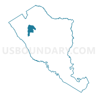
Outline

Summary
| Unique Area Identifier | 665531 |
| Name | Bells Voting District |
| County | Colleton County |
| State | South Carolina |
| Area (square miles) | 17.36 |
| Land Area (square miles) | 17.36 |
| Water Area (square miles) | 0.00 |
| % of Land Area | 100.00 |
| % of Water Area | 0.00 |
| Latitude of the Internal Point | 32.96361470 |
| Longtitude of the Internal Point | -80.84509560 |
Maps


Graphs
Select a template below for downloading or customizing gragh for Bells Voting District, Colleton County, South Carolina


Neighbors
Neighoring Voting District (by Name) Neighboring Voting District on the Map
- Hudson Mill Voting District, Colleton County, SC
- Lodge Voting District, Colleton County, SC
- Rice Patch Voting District, Colleton County, SC
- Ruffin Voting District, Colleton County, SC
- Sniders Voting District, Colleton County, SC
- Williams Voting District, Colleton County, SC
Top 10 Neighboring County Subdivision (by Population) Neighboring County Subdivision on the Map
- Walterboro CCD, Colleton County, SC (21,571)
- Hendersonville CCD, Colleton County, SC (5,955)
- Smoaks CCD, Colleton County, SC (1,840)
- Lodge CCD, Colleton County, SC (1,711)
Top 10 Neighboring Unified School District (by Population) Neighboring Unified School District on the Map
Top 10 Neighboring State Legislative District Lower Chamber (by Population) Neighboring State Legislative District Lower Chamber on the Map
Top 10 Neighboring State Legislative District Upper Chamber (by Population) Neighboring State Legislative District Upper Chamber on the Map
Top 10 Neighboring 111th Congressional District (by Population) Neighboring 111th Congressional District on the Map
Top 10 Neighboring Census Tract (by Population) Neighboring Census Tract on the Map
- Census Tract 9703, Colleton County, SC (5,955)
- Census Tract 9704.01, Colleton County, SC (4,424)
- Census Tract 9701, Colleton County, SC (1,840)
- Census Tract 9702, Colleton County, SC (1,711)